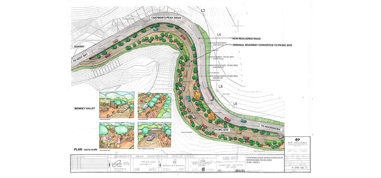
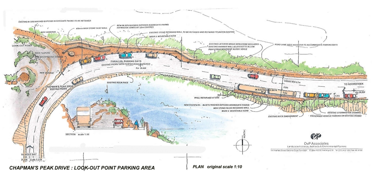
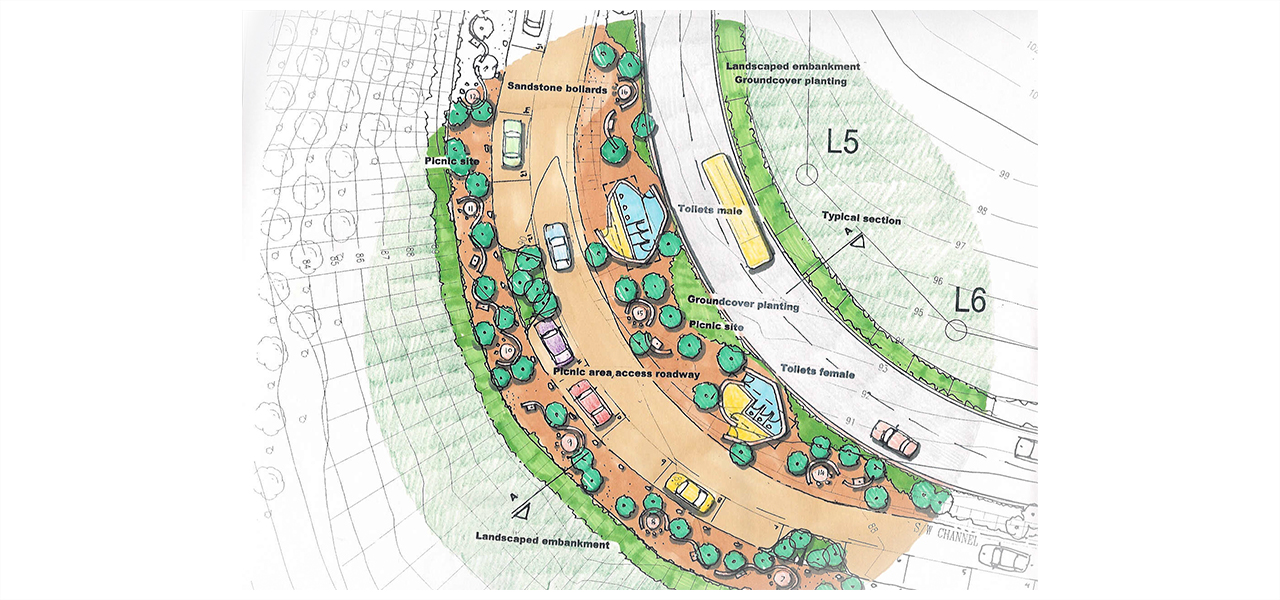
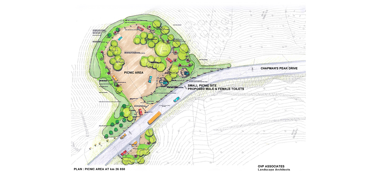
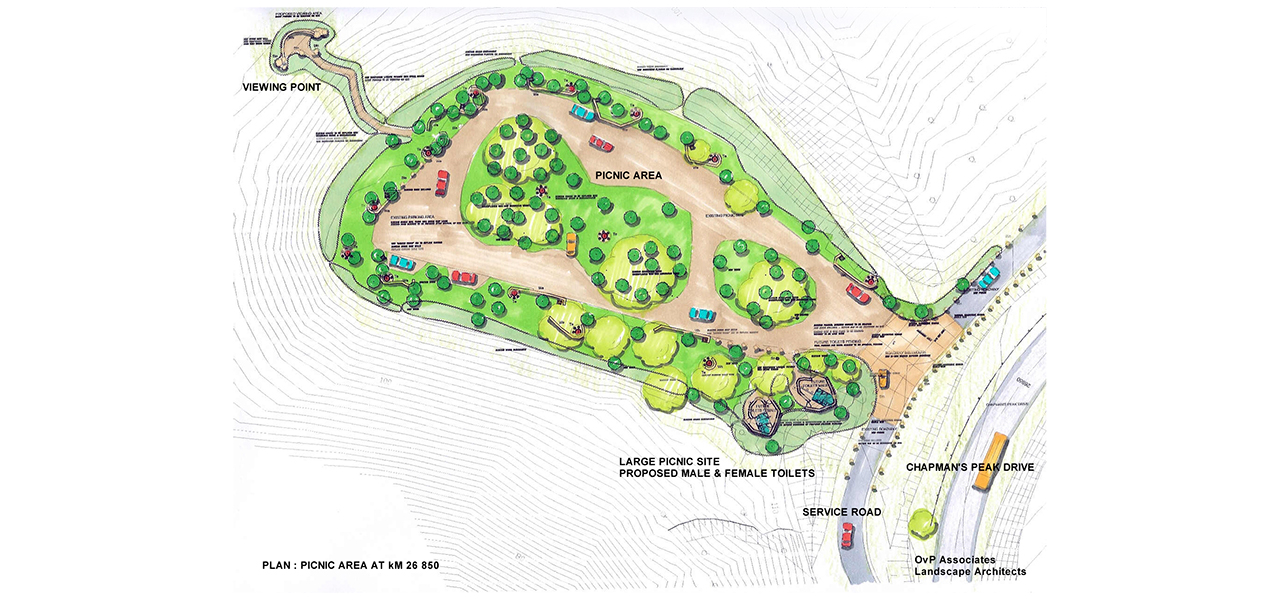
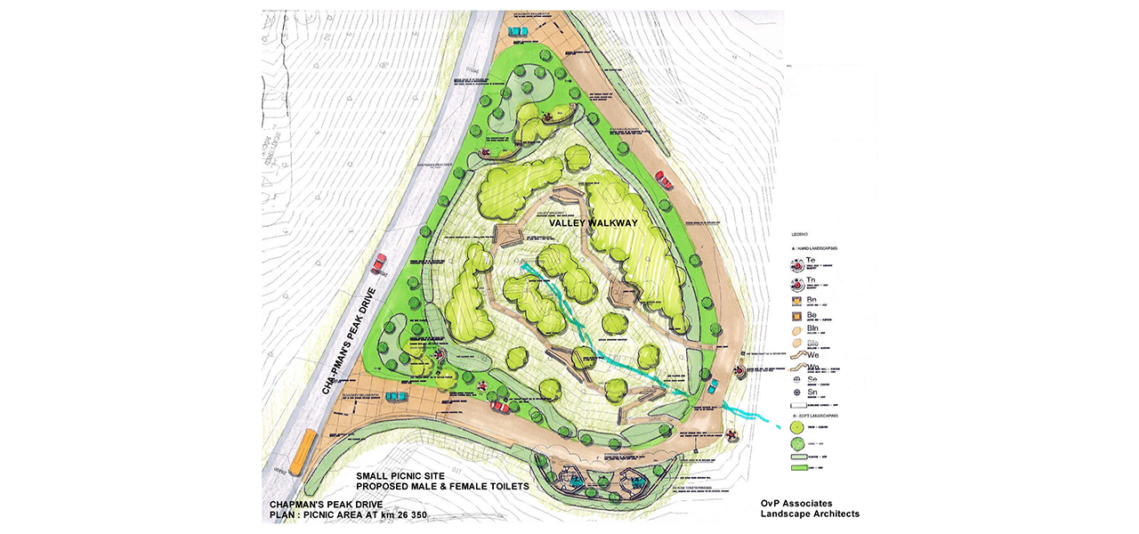
Chapman’s Peak Drive is a historic scenic driveway between Hout Bay and Noordhoek in the Cape Peninsula. Following closure in 2000 following a number of accidents and subsequent safety concerns, OvP provided professional landscape architectural services for the road upgrade, roadway rockfall canopies, protection and rehabilitation measures and viewing areas, including architectural services for the ablution areas and road tolling facilities.
Completed in 1922, Chapman’s Peak Drive provided a shortened route between the South Peninsula and Cape Town CBD and construction involved cutting into the side of the geologically unstable sides of the steep cliffs and mountain ravines.
In 1962 a section of the road was widened, in 1977 a portion of road was washed away, and subsequently the road was closed on 14 May, after a large section was washed away and the damaged section was replaced by a bridge.
In 1994, Noel Graham was injured and partly paralysed in a landslide incident on Chapman’s Peak Drive, which resulted in a court case.
Amidst increasing concern for public safety and legal liability, the South Peninsula Municipality (SPM) – the new road management agent appointed in 1997; established a sub-committee of officials from the local, metropolitan and provincial authorities to guide the management of Chapman’s Peak Drive, who instigated high visibility rockfall warning signs to be erected on Chapman’s Peak Drive during 1999, and also adopted a specific Chapman’s Peak Drive closure policy which stipulated that the road had to be closed to traffic in rainy weather and remain closed for a number of hours after cessation of any rainfall and until deemed safe.
On 29 December 1999 however, a falling rock caused the unfortunate death of a Noordhoek resident. In early January 2000, Ms Lara Callige was killed, and a passenger in the same car seriously injured in a rockfall incident on Chapman’s Peak Drive in good weather conditions when the rockfall risk on the road was not considered to be high. This was of serious concern to the local and provincial authorities alike and emergency meetings to discuss closure of Chapman’s Peak Drive were held between the relevant political bodies. Before a decision could be taken on the matter, and still in January 2000, the worst mountain fires in many decades raged in the Cape Peninsula, including in the mountains above Chapman’s Peak Drive, causing numerous rockfalls onto the road and effectively rendering the road impassable.
As a result of these incidents Chapman’s Peak Drive was officially closed to traffic indefinitely by the Provincial Minister of Transport in January 2000.
In that year, based on the recommendations of geotechnical specialists, the Provincial Administration’s Transport Branch implemented a contract for “rock-barring” (the removal loose or dangerous rocks) of the mountain slopes above the road to make them safer.
It soon became apparent that the rock-barring process deemed would take substantially longer than originally anticipated, cost commensurately more and in fact served to further destabilise the eroding mountain slope. Work was thus eventually stopped in May 2000 and an integrated environmental management process (IEM) was put in place with the goal of producing an agreed management plan for Chapman’s Peak Drive by mid-2001. The IEM process brief required management to include:
- the improvements deemed necessary to make the road safe for users,
- a strategy for managing/operating the road,
- recommendations on funding sources for the capital improvements as well as the continuing operational needs.
At the end of April 2001 the IEM process had included:
A review of the initial “rock-barring” work which concluded that some rock-barring may be necessary in the final upgrading process, but the “clean sweep” approach could not be condoned and the selective rock-barring also would have to be accompanied by various engineered rockfall protective measures in order to make the road safe for users.
A comprehensive stakeholder workshop in September 2000 which identified and agreed various improvements and protective measures which needed to be implemented on Chapman’s Peak Drive with the overriding and urgent requirement to re-open the road to traffic as soon as possible being supported by all participants.
A detailed site survey of the road itself and mountainside above and below the road to facilitate a concept design proposal (areas covered by rock and the time had to be omitted).
Completion of various concept design proposals incorporating some or all of the following elements: rock-barring, catch fences, rock gallery protection, concrete roof protection, existing structure repair, road surface and layerwork repair, slope stabilisation work above and below the road, etc.
Public meetings were held in late November 2000 to present the current status of the project to the general public in the Hout Bay and Noordhoek Valley areas and obtain relevant feedback from interested and affected parties, and further meetings in March 2001 presented the progress on the project.
The IEM process was guided by a project management team consisting of officials from the Provincial Administration, Western Cape, and officials from the City of Cape Town’s South Peninsula and CMC administrations.
The legal road authority for Chapman’s Peak Drive being the Provincial Administration Western Cape (PAWC) realised early on in 2000 that financial limitations would be the single biggest stumbling block to the safe re-opening of Chapman’s Peak Drive to traffic. To solve these financial problems the plan was to implement a public private partnership and proclaim the route a Toll Road under the Western Cape Provincial Toll Road Act. The feasibility study concluded that the majority of the costs attached to the Chapman’s Peak Drive reopening and operation could be obtained through tolling the road, and that a public private partnership with a concessionaire demonstrated value for money in terms of the risks transferred to the private sector.
The Chapman’s Peak Engineering Group Joint Venture was awarded the tender after being shortlisted and the project was overseen by Entilini concessions – the special-purpose company established by the consortium of Concor Holdings, Haw & Inglis and Marib Holdings.
The Joint Venture included Vela VKE Consulting Engineers, Meli & Du Plessis Geotechnical Engineers, Stewart Scott International, Zietsman Lloyd Hemsted and assisted by Megan Anderson Landscape Architect (environmentalist); OvP Associates (Landscape Architects); Dr Ross Party-Davies (geotechnical specialist) and Prof Rolf Kratz (structural design specialist).
For the rehabilitation and upgrading of Chapman’s Peak, due to the sensitive location within the Table Mountain National Park, an integrated environmental approach, was required. Extensive and complex engineering work was undertaken to ensure that rock fall protection and edge safety barriers were installed, along with an advanced traffic management system.
After intensive design and reconstruction Chapman’s Peak Drive was re-opened to traffic as a toll road, including the controversial building facilities cleverly concealed in a road cutting on the lower slopes, on 20 December 2003. The opening was a welcome return for the drive as an “international tourist destination” complementing other tourist destinations in the Western Cape. Local businesses also welcomed the re-opening.
The new rock fall measures were however put to the test, and during July and August of 2004, three rainfall incidents occurred of extremely high intensity. (A total of 396mm was recorded in the 2 months, compared to the mean annual precipitation for the area of 740mm) Shortly thereafter several debris slides and rockfall incidents occurred, resulting in damage to the catch fences and Chapman’s Peak Drive was closed for 55 days to clear the debris and replace the 4 catch fences.
The much loved road was back in the news when Chapman’s Peak Drive was once again declared unsafe for road users in June 2008 and the drive was closed for major upgrades and repairs. The construction work took over a year and was eventually re-opened on the 9th October 2009. Chapman’s Peak Drive has remained open since then, albeit with temporary closures for routine maintenance and during dangerous weather conditions.
Adapted from source: chapmanspeakdrive.co.za

